

Outdoor Navigation Tools: The 2026 Field Guide for Hikers

Updated: Sep 5

What are the best outdoor navigation tools right now?
The short answer: a layered system beats any single device. The gold standard for wilderness navigation combines a smartphone with offline maps as your primary, a dedicated GPS unit or satellite communicator as your rugged backup, and a paper map with a magnetic compass as the fail-safe that never needs charging. That three-layer approach is what professional guides and search-and-rescue teams actually use, and it’s the framework this guide is built around.
The top devices worth knowing in 2026:
Garmin GPSMAP 67 — the all-in-one for serious backcountry hikers; full onboard topo maps, multi-band GPS accuracy, and built-in two-way satellite SOS in one unit
Garmin eTrex 32x — a lighter, more affordable handheld that covers the core functions well for most off-trail trips
Garmin inReach Mini 2 — the smallest, lightest way to add two-way satellite messaging and SOS; runs up to 650 hours in expedition tracking mode
CalTopo — the desktop planning standard used by SAR professionals for multi-page map printing and high-resolution slope angle shading
onX Backcountry — the go-to for land ownership data and property boundaries, especially in the American West
Here’s how the main categories stack up at a glance:
Category | Best for | Accuracy | Battery life | Key feature | Durability | Price range |
Handheld GPS (e.g., GPSMAP 67) | Off-trail, multi-day, all-weather | 3 m under open sky | 16 hrs | Onboard topo maps, SOS | High (water/drop resistant) | $300–$650 |
GPS watch | Endurance athletes, lightweight trips | Good for tracking | Varies by model | Wrist-based data, compact | Moderate to high | $200–$700 |
Smartphone + app | Day hikes, trail navigation | Good with signal | several hours active GPS | Large screen, rich map layers | Low (cold/wet vulnerable) | App cost only |
Satellite messenger (e.g., inReach Mini 2) | Remote, solo, multi-day | Location ping | Days to weeks | Two-way messaging, SOS | High | around $350 + subscription |
Magnetic compass | Backup, off-grid navigation | Direction only | Infinite | No batteries needed | Very high | $15–$75 |
Paper topo map (USGS 1:24,000) | Backup, terrain planning | Terrain-dependent | Infinite | Full terrain detail | High (waterproof options) | Free to low cost |
Mapping apps (CalTopo, onX) | Trip planning, terrain analysis | Map-dependent | N/A (desktop/app) | Slope shading, land data | N/A | subscription fees vary |
Consumer-grade GPS devices typically achieve horizontal accuracy of a few meters under open sky, which is a level of precision that a paper map and compass alone cannot match. But that precision disappears when the battery dies. Every tool in this guide has a specific job, and knowing which job belongs to which tool is what separates hikers who get home safely from those who don’t.
How do the different types of navigation tools actually work in the field?
Handheld GPS devices
Dedicated handheld GPS units are the workhorse of backcountry navigation. They receive signals from the satellite constellation maintained by the U.S. Space Force, calculate your position through trilateration, and display it on a loaded topo map. The Garmin GPSMAP 67 represents the current high end: multi-band reception for faster satellite lock, preloaded TopoActive maps, and integrated two-way satellite messaging via the inReach network. The Garmin eTrex 32x sits at the more accessible end, covering the core functions (waypoints, tracks, topo maps) at a lower price and weight.
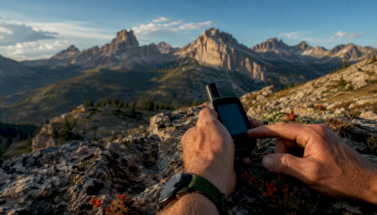
The real advantage over a smartphone isn’t accuracy. It’s endurance and toughness. A dedicated GPS unit offers significantly longer battery life and better cold resistance than a smartphone. The screen is matte and readable in direct sunlight, where a phone display washes out completely.
Pros:
Long battery life, unaffected by cold
Rugged, water-resistant construction
Reliable satellite lock in dense canopy and canyon terrain
Stores detailed topo maps onboard
Cons:
Smaller, lower-resolution screen than a smartphone
Heavier and bulkier than a phone
Onboard maps often less current than app-based alternatives
Higher upfront cost
GPS watches
GPS watches earn their place for endurance athletes and ultralight hikers who already own one. They record distance, elevation gain, pace, and track, all from your wrist without pulling out a device. The tradeoff is a tiny screen with no real map display. You can see your coordinates or a breadcrumb trail, but you cannot read terrain the way you can on a phone or handheld. For navigation decisions in complex terrain, a GPS watch is a supplement, not a primary tool.
Pros:
Wrist-accessible data at a glance
Lightweight, no extra carry weight if you already own one
Good for tracking athletic performance alongside navigation
Cons:
No usable map display
Cold weather affects battery life similarly to phones
Not a standalone navigation solution
Smartphone GPS apps
A smartphone with offline maps downloaded is genuinely the best primary navigation tool for most hikers on marked trails. The screen is larger and clearer than any handheld. Apps like Gaia GPS offer 50+ map layers including USGS topographic maps at 1:24,000 scale, slope angle shading for avalanche assessment, and offline downloads for any region. CalTopo is the desktop planning standard for SAR professionals, offering multi-page map printing and high-resolution slope angle shading. onX Backcountry adds property boundary data that matters specifically for hikers in the American West navigating public-private land corridors.

The critical preparation step is downloading offline maps before you leave cell service. An app that requires a connection to display your position is useless in the backcountry.
Pros:
Large, high-resolution touchscreen
Access to frequently updated, rich map layers
No additional weight if you carry a phone anyway
Low or no additional cost
Cons:
Active GPS tracking in cold weather reduces smartphone battery life to about 4 hours, which usually necessitates carrying a power bank or external battery for longer outings.
Physically fragile compared to dedicated GPS units
Screen glare in direct sunlight
Emergency SOS on newer phones is limited and less proven than dedicated satellite communicators
Satellite messengers
Dedicated satellite communicators remain the backcountry standard for off-grid communication and emergency support. The Garmin inReach Mini 2 is the most cited example: it sends two-way messages and an SOS from almost anywhere with a view of the sky, leaves tracking breadcrumbs that search teams can work from, and runs for days on a single charge. Newer smartphones have added emergency satellite SOS, but it’s emergency-only, needs a clear sky view, and is far less proven than a dedicated unit.
Pros:
Two-way messaging from virtually anywhere
SOS with precise location tracking for rescuers
Extremely long battery life
Small and light (inReach Mini 2 weighs 3.5 oz)
Cons:
Requires a subscription plan for messaging
Basic navigation features only on smaller models
Higher ongoing cost than a one-time device purchase
Magnetic compass
A magnetic compass is the navigation tool that never runs out of battery, never cracks, and never loses signal. Wilderness safety experts consistently emphasize that paper map and compass proficiency is the skill gap that gets people into serious trouble when electronics fail. A baseplate compass like the Brunton TruArc 3 handles basic orientation for around $16. For serious off-trail use, a model with adjustable declination, like the Suunto M-3G Global Pro, gives you the precision needed for long-distance bearing work.
Pros:
Zero battery dependency
Extremely durable and reliable
Works in any weather, any temperature
Inexpensive
Cons:
Requires practiced skill to use accurately
Direction only, no position data
Magnetic declination must be adjusted for your region
Altimeters and barometric instruments
An altimeter tells you your elevation, which is one of the most useful pieces of navigation data in mountainous terrain. Most ABC watches (altitude, barometer, compass) and many dedicated GPS units include a barometric altimeter. Barometric pressure changes also serve as a weather warning: a rapid pressure drop often signals incoming storms. In terrain where trails are sparse and landmarks are few, knowing your exact elevation and cross-referencing it against a topo map’s contour lines can confirm your position when GPS signal is weak.
Pros:
Elevation data aids position confirmation on topo maps
Barometric pressure changes give early weather warnings
Available on many GPS watches and handhelds
Cons:
Requires calibration at a known elevation point
Pressure changes from weather can affect accuracy
Not a standalone navigation solution
How do you build a navigation system that won’t fail you?
Redundancy is the principle that separates experienced backcountry travelers from those who get rescued. No single device should be your only navigation tool in technical terrain. The three-layer system trusted by professionals works like this: your smartphone with offline maps is the primary, with the best screen and the richest map data. A dedicated GPS unit or satellite communicator is the rugged, long-battery backup. A paper map and compass is the third layer, the one that functions regardless of what happens to everything else.
Selecting the right combination depends on your trip type. A day hike on a marked trail in a national park needs far less than a five-day solo off-trail route in the Cascades. Here’s a practical framework:
Trip-based system selection:
Day hike on marked trails: Smartphone with offline maps downloaded, baseplate compass, printed trail map
Multi-day backpacking: Smartphone, dedicated GPS unit or satellite communicator, baseplate compass, paper USGS topo quads for the route
Off-trail or cross-country navigation: All of the above, plus practiced map-and-compass skills, altimeter watch, and a satellite messenger with SOS
Solo remote expeditions: Full three-layer system, satellite communicator with two-way messaging, and a personal locator beacon as a fourth layer
Battery life management:
Battery failure is the most common reason digital navigation tools stop working in the field. Cold weather significantly impacts smartphone battery life during GPS use, so seasoned hikers carry power banks and keep devices warm inside a jacket pocket. A lithium AA battery in a Garmin GPS lasts multiple hours in standard mode, which may be limited on longer trips without resupply. Adjusting tracking intervals can extend battery life considerably. Devices like the Garmin inReach Mini 2 offer extended runtimes suitable for multi-day trips.
System components checklist:
Smartphone with offline maps downloaded for your specific route area
External battery pack (10,000 mAh minimum for multi-day trips)
Dedicated GPS unit or satellite communicator
Baseplate compass with adjustable declination
Paper USGS topo map for your route area (waterproof or in a dry bag)
Knowledge of how to use all three layers, not just the phone
For a deeper look at how to integrate these tools into a practical field workflow, Thrillofit’s guide on building your field system covers the mobile app versus paper map tradeoffs in detail.
Pro Tip: Before every trip, test your offline maps by putting your phone in airplane mode at home and confirming the map loads and your GPS position updates. Many hikers discover their offline download failed only after they’ve lost cell service.
When choosing gear for rugged terrain, the durability and field-readiness of your equipment matters as much as its features. FS9 Tactical’s guide on selecting adventure travel gear covers the durability considerations that apply directly to navigation device selection.
How do the top GPS devices and apps compare side by side?
The five tools that come up most consistently in serious backcountry navigation discussions are the Garmin GPSMAP 67, Garmin eTrex 32x, Garmin inReach Mini 2, CalTopo, and onX Backcountry. They serve different roles, and understanding those roles prevents you from buying the wrong one.
Device/App | Best for | Accuracy | Battery life | Key features | Durability | Price | Typical use scenario |
Garmin GPSMAP 67 | All-in-one backcountry | Multi-band, 3 m | 16 hrs standard | Onboard topo, two-way satellite SOS, multi-band | MIL-STD-810, IPX7 | ~$600 | Multi-day off-trail, solo expeditions |
Garmin eTrex 32x | Affordable off-trail GPS | 3 m | 25 hrs | Topo maps, waypoints, tracks, 3-axis compass | IPX7 | around $200 | Day hikes to moderate backpacking |
Garmin inReach Mini 2 | Emergency comms + tracking | Location ping | Up to 650 hrs expedition | Two-way satellite messaging, SOS, tracking | IPX7 | around $350 + subscription | Remote, solo, multi-day trips |
CalTopo | Desktop trip planning | Map-dependent | N/A (web app) | Multi-page printing, slope shading, SAR-grade tools | N/A | Free–$50/yr | Pre-trip route planning, avalanche terrain |
onX Backcountry | Land access and boundaries | Map-dependent | N/A (mobile app) | Property boundaries, 650,000+ trail miles, avalanche data | N/A | subscription fees near $100/yr | American West, private land navigation |
Garmin GPSMAP 67
The GPSMAP 67 is the device that shows up as “best overall” in most serious roundups, and the reason is straightforward: it handles everything in one unit. Multi-band GPS reception gives faster satellite lock and better accuracy in challenging terrain like canyons and dense forest. The built-in inReach satellite communication means you carry one device instead of two. It meets MIL-STD-810 testing standards and carries an IPX7 waterproof rating. At around $600, it’s a significant investment, but for frequent backcountry hikers who want a single device that covers navigation and emergency communication, nothing else at this price point matches it.
Garmin eTrex 32x
The eTrex 32x is the practical choice for hikers who want dedicated GPS capability without the GPSMAP 67’s price or bulk. It runs roughly 25 hours on two AA batteries, loads topo maps, records tracks, and manages waypoints. The screen is small and the interface is button-based rather than touchscreen, which some hikers prefer in gloves or wet conditions. For day hikes and moderate backpacking trips where you want a reliable GPS backup to your phone, the eTrex 32x covers the job at a fraction of the cost.
Garmin inReach Mini 2
The inReach Mini 2 is the most frequently recommended single device for backcountry safety, and the reason is its battery life. Up to 650 hours in expedition tracking mode means a thru-hiker can go weeks between charges. Two-way satellite messaging works from virtually anywhere with a view of the sky, and the SOS function leaves precise tracking breadcrumbs that search-and-rescue teams can work from. It’s not a full navigation device on its own, but paired with a smartphone for maps, it covers the emergency communication gap that no phone app can reliably fill.
CalTopo
CalTopo is where serious trip planning happens before you leave the house. SAR professionals use it for its multi-page map printing capability and high-resolution slope angle shading, which assesses avalanche risk at a detail level that mobile apps can’t match. The web-based platform lets you build a route on a desktop, print paper backup pages, and export the route to a field navigation app. For planning a technically complex backpacking trip, CalTopo’s desktop tools are more powerful than any mobile alternative. The free tier covers basic use; the Pro tier at $50 per year adds collaborative sharing and enhanced printing.
onX Backcountry
onX Backcountry’s differentiating feature is land ownership data. In the American West, where wilderness trailheads often require crossing private land corridors, knowing exactly who owns each parcel before you arrive prevents trespassing and legal trouble. The app covers 650,000+ miles of trails with detailed descriptions, property boundaries, and avalanche forecast integration. It’s the most sport-specific option for US backcountry users where land access is a genuine planning concern, and it pairs well with Gaia GPS for hikers who need both land access data and deep topo map layers.
What navigation skills do you actually need to use these tools well?
Tools are only as good as the person using them. Assuming digital devices replace foundational navigation skills leads to the kind of overconfidence that gets people lost. The Appalachian Mountain Club puts it plainly: a map and compass will do little good if you don’t know how to use them, and misuse can turn simple confusion into being totally lost.
Reading topographic maps
USGS 7.5-minute quadrangle maps at 1:24,000 scale are the standard for detailed navigation on federal land in the United States. At that scale, one inch on paper equals 2,000 feet on the ground. Contour lines show elevation change, with each line connecting points of equal elevation. On USGS quads, contour intervals are typically 40 feet. The closer the lines, the steeper the slope. Every fifth line is a darker index line labeled with its elevation.
Key map-reading skills to practice:
Identifying terrain features: ridgelines, drainages, saddles, cliffs, and peaks all have distinct contour signatures
Estimating distance: use the map scale to convert map inches to ground distance before committing to a route
Orienting the map: rotate the map so its features align with the terrain in front of you, not just north-up by default
Reading contour intervals: a cluster of tight contours on a topo means a cliff band that won’t appear on a trail map
The U.S. Geological Survey offers free topographic maps you can download and print at US Topo, which makes paper backup maps essentially free for any trip in the United States.
Using a compass accurately
Orienting a map with a compass is the most important skill to master for backcountry navigation. The process involves aligning the compass baseplate with the map’s true north arrow, adjusting for local magnetic declination, and rotating the map until the magnetic needle overlays the orienteering arrow. Once the map is oriented to the terrain, your situational awareness improves dramatically.
Magnetic declination is the angle between magnetic north (where your compass needle points) and true north (as marked on your map). In the contiguous United States, declination varies regionally and must be properly adjusted for accurate navigation. Ignoring declination on a long route translates a small angular error into a positional error measured in miles.
Compass skills to develop before you need them:
Setting a bearing from your current location to a destination on the map
Following a bearing across terrain by sighting on distant landmarks rather than staring at the compass
Triangulating your position by taking bearings to two or more known landmarks
Reversing a bearing to return to your starting point
Integrating altimeters and barometric pressure
An altimeter confirms your elevation, which cross-referenced against a topo map’s contour lines can pinpoint your position when GPS signal is unreliable. Calibrate your altimeter at a known elevation point at the start of each day. Watch for rapid barometric pressure drops, which often precede deteriorating weather by several hours, giving you time to make camp or turn back before conditions worsen.
Natural navigation techniques
Natural navigation supplements your tools when batteries die or devices fail. The sun rises roughly in the east and sets roughly in the west, giving you a general east-west reference throughout the day. At night, Polaris (the North Star) sits within about one degree of true north and can be found by extending the line from the two outer stars of the Big Dipper’s bowl. Prominent landmarks like peaks, ridgelines, and river drainages serve as reference points for maintaining your bearing across open terrain.
These techniques won’t replace a GPS, but they provide a sanity check when your digital tools give you a reading that doesn’t match what you’re seeing in front of you. Developing foundational navigation skills alongside your digital tools is what makes the difference between a hiker who recovers from a device failure and one who doesn’t.
Practicing before you need it
Practice map-and-compass navigation in familiar terrain before your safety depends on it. Start in a local park where you know the landmarks. Take a bearing to a visible feature, follow it, and confirm your arrival. Work up to navigating between two points without a trail. The National Center for Outdoor and Adventure Education recommends practicing in areas you know well to build confidence before tackling unfamiliar terrain. If you ever find yourself in a situation where your tools fail and your skills are all you have, the time to discover gaps in your knowledge is not then. For situations where navigation failure leads to a genuine emergency, understanding wilderness self-rescue principles is the logical next step.
Thrillofit has the outdoor navigation resources you need
If you’ve made it this far, you’re serious about getting your navigation system right. That’s exactly the kind of hiker Thrillofit is built for.
Thrillofit covers the full range of outdoor navigation and wilderness preparedness content that goes beyond gear specs: practical skill-building guides, survival tactics, gear recommendations grounded in real field use, and safety frameworks that professional guides actually apply. Whether you’re building your first three-layer navigation system or refining your off-trail compass technique, the site’s library of outdoor adventure guides gives you the depth to make confident decisions in the field. For hikers who want to go further into emergency preparedness alongside navigation, Thrillofit’s coverage of outdoor emergency gear categories connects navigation tools to the broader safety kit that keeps you covered when conditions change fast.
Key Takeaways
A layered navigation system combining digital tools with traditional map-and-compass skills is the only approach that holds up when conditions, terrain, or battery life work against you.
Point | Details |
Use a three-layer system | Combine a smartphone with offline maps, a dedicated GPS or satellite communicator, and a paper map with compass for full redundancy. |
Battery life determines reliability | Smartphone GPS lasts about 4 hours in cold; the Garmin inReach Mini 2 runs up to 650 hours in expedition mode. |
Declination adjustment is non-negotiable | Magnetic declination can reach about ±20° across the U.S.; ignoring it turns a small error into miles of positional drift. |
CalTopo and onX serve planning, not just navigation | CalTopo handles pre-trip route printing and slope analysis; onX Backcountry adds property boundary data critical for the American West. |
Thrillofit for skill depth | Thrillofit’s guides cover navigation workflows, wilderness self-rescue, and survival skills that make your gear system actually work in the field. |
Recommended
Comments