

Advantages of Outdoor Navigation Skills for Hikers


TL;DR:
Outdoor navigation skills help prevent backcountry emergencies, build self-reliance, and enhance wilderness exploration. Mastering map reading, compass use, and terrain association takes minimal time but provides lifelong safety benefits. Using layered navigation methods ensures reliability in any terrain or weather condition.
Outdoor navigation skills are the practical competencies that let you find your way through wilderness terrain using maps, compasses, and direct observation of the land around you. These skills are the foundation of safe, confident backcountry travel, and the advantages of outdoor navigation skills extend well beyond simply knowing which direction is north. Mastering techniques like topographic map reading, compass bearing, and terrain association reduces your dependence on battery-powered devices, sharpens your situational awareness, and gives you the independence to explore places most hikers never reach. Whether you are a weekend camper or a serious adventure traveler, these skills are worth building.
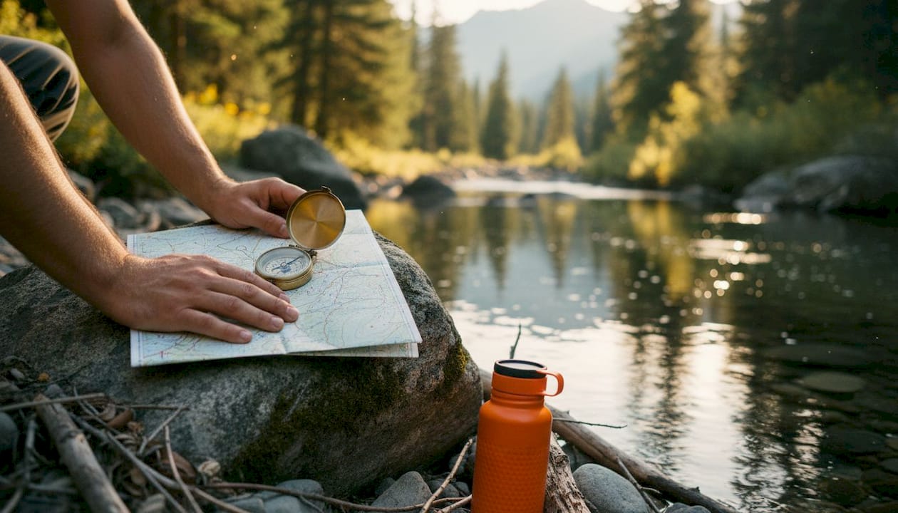
1. What are the core advantages of outdoor navigation skills for safety?
Navigation failure is a leading cause of backcountry emergencies. Over 3,000 search-and-rescue incidents occur annually in National Park Service lands, and many victims carried GPS devices that failed them. That number proves that gear alone does not keep you safe. Skill does.
When you read a topographic map and match it to the terrain in front of you, you catch route errors before they become crises. You recognize a ridge that does not match your expected line of travel and correct course immediately. That proactive awareness is what separates hikers who stay found from those who need rescuing.
Navigation errors also drain your physical reserves. Getting lost compounds survival risks by burning extra energy and increasing exposure time. Every wrong mile you walk is a mile your body spends fuel it needs for shelter, warmth, and water management.
Key safety benefits of strong navigation skills include:
Catching route drift early before terrain becomes unfamiliar
Identifying water sources, ridgelines, and escape routes on a map before you need them
Maintaining a reliable backup when GPS signal drops or batteries die
Reducing panic-driven decisions by staying oriented at all times
Pro Tip: Before every hike, mark three terrain features on your map that you expect to cross. Checking them off as you travel keeps your position confirmed and your confidence high.
2. How navigation skills build self-reliance and confidence
Navigation transforms hikers from passive trail followers into active pathfinders who choose their own lines through the wilderness. That shift in mindset is one of the most underrated benefits of navigation skills. You stop depending on a blue dot on a screen and start reading the land itself.
The time investment to reach functional competence is shorter than most people expect. Core skills like map orientation and compass bearing can be practiced in a single afternoon, with roughly 5–10 minutes on map orientation and 30 minutes on bearing drills to build a working foundation. That is a low barrier for a skill that pays off on every trip.
Building self-reliance through navigation follows a clear progression:
Learn map orientation. Align your map to the terrain using a compass or prominent landmarks before you take a single step.
Practice taking bearings. Shoot a bearing to a visible feature, then walk to it without looking at the compass every few seconds.
Add triangulation. Use two known landmarks to confirm your position on the map, especially in featureless terrain.
Practice terrain association. Continuously compare what you see around you to what the map shows, building a running mental picture of your location.
Calibrate your pace count. Walk a known distance and count your steps to establish a personal baseline for estimating travel distance.
Each step reduces your anxiety and increases your range. Hikers who complete this progression report a measurable drop in trail anxiety because they know they can find their way out regardless of what their phone does.
Wilderness self-rescue situations almost always reward the person who can navigate. Knowing your position and the fastest route to a road or trailhead is the single most useful skill when things go wrong.
3. Key outdoor navigation techniques and their specific benefits
Different navigation methods solve different problems. Using them together gives you a layered system that holds up across varied terrain and conditions.
Map reading and contour interpretation
Topographic maps show elevation changes through contour lines, and reading them accurately tells you where cliffs, drainages, and saddles sit before you arrive. This preview lets you plan rest stops, water collection points, and alternate routes from camp. The importance of map reading cannot be overstated for off-trail travel, where the map is your only reliable reference.
Compass use and magnetic declination
A compass gives you a fixed reference that never needs charging. The critical technical detail most beginners miss is magnetic declination. Ignoring a 15-degree declination on a 5-mile route produces an endpoint error of roughly 1.3 miles. That error puts you in the wrong drainage, on the wrong ridge, or facing an unexpected cliff. Adjusting your compass for local declination takes 30 seconds and eliminates that risk entirely.
GPS as a complement, not a replacement
GPS devices and smartphone apps are useful tools for recording tracks and confirming position. They are not reliable primary navigation systems in the backcountry. Batteries deplete faster in cold weather, satellite signals drop in deep canyons, and screens crack. Treat GPS as a secondary check on your map and compass work, not a substitute for it.
Natural navigation for situational awareness
Reading sun angle, prevailing wind direction, moss growth patterns, and star positions gives you a directional sense that works when every device fails. Natural navigation is not a primary system, but it sharpens your environmental awareness and keeps you connected to the terrain in a way that GPS use never does.
Pro Tip: Set your compass declination before you leave the trailhead. Most baseplate compasses have an adjustable declination scale. Check the current declination for your region on the NOAA website before each trip.
4. How navigation skills sharpen your mind and enrich your experience
Active navigation engages your brain in ways that passive GPS use does not. When you read a map and match it to terrain, you build spatial memory, practice pattern recognition, and develop a mental model of the landscape that stays with you long after the trip ends.
Expert navigators maintain a running estimate of their position by continuously comparing terrain to map, anticipating what comes next rather than reacting to confusion after the fact. That habit of forward thinking transfers directly to better decision-making in all outdoor situations.
The cognitive benefits of skilled navigation include:
Stronger spatial awareness that improves route selection on future trips
Deeper observation of landforms, vegetation zones, and water patterns
Greater enjoyment of the landscape because you understand what you are looking at
Reduced mental fatigue from uncertainty, since you always know roughly where you are
Navigation also changes how you experience a place. When you find a hidden lake by reading a contour map rather than following a marked trail, the discovery feels earned. That sense of genuine exploration is what keeps serious hikers coming back to the backcountry year after year.
Building these skills also supports wilderness self-reliance at a deeper level. You stop being a visitor who follows signs and start being a traveler who reads the land.
5. Common navigation challenges and how to overcome them
Every navigator faces predictable problems. Knowing them in advance lets you prepare rather than react.
Pace count drift is one of the most common errors. Most adults average about 2,000 steps per mile on flat ground, but that number changes significantly under load and on steep terrain. Pace count shifts from roughly 65 paces per 100 meters to 75–80 paces when you add a heavy pack or climb a steep grade. Recalibrate your pace count on different terrain types before you rely on it for critical distance estimates.
Terrain and map discrepancies happen when trails are rerouted, when seasonal water sources dry up, or when dense vegetation hides the landforms you expect to see. The rule is to trust ground truth over the map when the two conflict, then figure out why they disagree before moving on.
Common pitfalls that skilled navigators actively avoid:
Panic walking. Moving fast when disoriented burns energy and takes you further from your last known position. Stop, sit down, and work the problem with your map.
Confirmation bias. Forcing the terrain to match the map instead of admitting you are off route. If three features do not match, you are in the wrong place.
Over-reliance on a single method. No technique works in every condition. Rotate between map, compass, terrain association, and natural cues as conditions change.
“The goal of navigation is not to avoid getting lost. It is to know where you are at all times so that getting lost becomes nearly impossible. That requires constant attention, not occasional glances at a screen.”
Practicing these habits on easy terrain before you need them on hard terrain is the only way to build genuine competence. Start on familiar trails, then push into less-marked terrain as your confidence grows.
Key Takeaways
Mastering outdoor navigation skills reduces wilderness emergencies, builds lasting self-reliance, and deepens your connection to the terrain in ways that GPS alone never will.
Point | Details |
Safety through skill | Navigation competence prevents the majority of backcountry emergencies, even when GPS devices are present. |
Fast skill acquisition | Core map and compass skills are achievable in a single afternoon of focused practice. |
Declination matters | Adjusting for magnetic declination eliminates route drift that can exceed one mile on a moderate hike. |
Active navigation sharpens the mind | Continuous terrain-to-map comparison builds spatial memory and improves all outdoor decision-making. |
Layered methods win | Combining map, compass, GPS, and natural navigation creates a system that holds up in any condition. |
Why navigation skills are the one outdoor competency I never skip
I have watched confident hikers freeze at trail junctions because their phone died. I have also watched a navigator with a worn paper map and a baseplate compass walk out of a whiteout without hesitation. The difference was not gear. It was practice.
Navigation is the one outdoor skill that multiplies the value of every other skill you have. Knowing desert survival basics matters far more when you can actually find the water source you identified on the map. First aid knowledge is more useful when you can navigate to a trailhead rather than waiting for a rescue team to find you.
My honest take is that most hikers underinvest in navigation because it feels technical and old-fashioned. It is neither. A compass bearing takes seconds to shoot. A contour line takes seconds to read. The investment is small and the return is permanent. Every hour you spend practicing with a map and compass pays dividends on every trip you take for the rest of your life. Practice it on your next easy day hike. You will not regret it.
— S
Thrillofit has the resources to sharpen your outdoor skills
Building real navigation competence takes the right guidance, and Thrillofit covers the full range of skills that keep you safe and capable in the backcountry.
From foundational hiking tips for beginners to advanced survival techniques, Thrillofit publishes practical, experience-backed content for outdoor enthusiasts at every level. The site covers map reading fundamentals, gear selection, wilderness first aid, and survival priorities, all in one place. If you are serious about spending more time in wild places and less time worrying about what could go wrong, Thrillofit is the resource worth bookmarking before your next trip.
FAQ
What are the main advantages of outdoor navigation skills?
Outdoor navigation skills prevent backcountry emergencies, reduce dependence on battery-powered devices, and build the confidence to travel safely in remote terrain. They also sharpen spatial awareness and deepen your overall wilderness experience.
How long does it take to learn basic map and compass skills?
Core skills like map orientation and compass bearing can be learned in a single afternoon. Roughly 5–10 minutes of orientation practice and 30 minutes of bearing drills build a solid working foundation.
Why does magnetic declination matter for hikers?
Ignoring magnetic declination causes your compass bearing to drift from true north. On a 5-mile route with a 15-degree declination error, your endpoint can shift by more than one mile, placing you in completely the wrong location.
Can GPS replace traditional navigation skills?
GPS is a useful backup tool, but it cannot replace map and compass skills. Batteries fail in cold weather, signals drop in canyons, and screens break. Traditional navigation skills work when every electronic device fails.
How do navigation skills help in a wilderness emergency?
Knowing your position and the fastest route to a road or trailhead is the most critical skill in any wilderness emergency. Navigation competence supports self-rescue and reduces the time and energy spent waiting for outside help.
Recommended
Comments