

Weather Awareness: The Skill That Keeps Hikers Alive
- Wesley Coldwell
- 1 day ago
- 9 min read

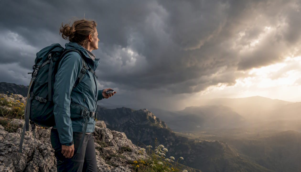
Weather awareness is what turns a forecast into a decision. It tells you when to pack the extra layer, when to skip the ridge, and when to turn around before the sky makes that choice for you. Ignore it, and a routine afternoon hike can become a lightning strike, a flash flood, or a night spent hypothermic on an exposed slope.
NOAA’s own guidance is blunt about the stakes: lightning, flash floods, and hypothermia rank among the most preventable outdoor deaths, and the agency’s core advice is to check weather.gov before you leave and again once you’re moving. Lightning alone kills an average of 20 people a year in the U.S., most of them caught outside during recreation. Thrillofit builds every safety guide around one idea: the forecast gets you out the door, but your own eyes and ears keep you alive once you’re on the trail.
Here’s what to do before your next trip, starting today:
Pull the hourly point forecast for your exact trailhead and summit elevation, not the nearest town.
Set a hard turnaround time before you leave the car, and agree on it as a group.
Pack layers for the coldest, wettest scenario the forecast shows, not the average one.
Watch cloud growth and wind shifts once you’re moving. They update faster than any app.
Check air quality if wildfire smoke has been active anywhere upwind in the past week.
Pro Tip: Bookmark the NWS point forecast page for your specific trailhead before you go. A single tap in the field beats fumbling for a search when clouds start stacking up.
Key Takeaways
Weather awareness works because it converts a forecast into specific, pre-agreed actions instead of leaving safety decisions to judgment calls made mid-storm.
Point | Details |
Check elevation-specific forecasts | Valley conditions don’t predict ridge or summit weather, especially in storm season. |
Set turnback rules in advance | Audible thunder and rapid cloud growth should trigger retreat automatically, not debate. |
Pack for the worst case | Layer for the coldest, wettest point of your route, not the trailhead conditions. |
Watch the sky, not just the app | Cloud growth and wind shifts update faster in the field than any forecast refresh. |
One habit matters most | Recheck conditions every 20 to 30 minutes once you’re moving in unstable weather. |
Table of Contents
The Role of Weather Awareness in Outdoor Safety
Weather awareness matters because terrain amplifies weather in ways flat-ground forecasts don’t capture. A canyon floor that looks bone dry can flood from a storm dropping rain ten miles upstream, out of sight and out of earshot.
Three scenarios show how fast conditions escalate:
Ridgelines in storm season: Cumulus clouds build vertically in under an hour in mountain terrain, and by the time you hear thunder, you’re already in range of a strike.
Desert heat: A midday start in exposed terrain with inadequate water turns into heat exhaustion within a few hours, especially above 90°F with no shade plan.
Wet, windy exposure: Hypothermia doesn’t require freezing temperatures. Wind-driven rain at 50°F strips body heat faster than dry cold at 20°F.
Weather-related incidents account for a meaningful share of outdoor rescue calls, and lightning fatalities average 20 per year nationally, a number driven almost entirely by people who kept moving after they heard the first rumble instead of turning back.
Pro Tip: Pre-commit to your most conservative decision before you’re tired, cold, or excited to reach the summit. Fatigue and summit fever both erode judgment exactly when you need it most.
Weather Hazards by Season and Terrain
Different terrain produces different threats, and recognizing the visual cues early buys you the time to react.
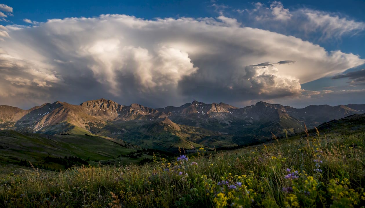
Thunderstorms and lightning: Anvil-shaped cumulonimbus clouds and rapid vertical growth signal storms that can form in under an hour. Standard guidance is to be off exposed ridges and summits by early afternoon during unstable-weather months.
Heat illness: Shimmering heat off rock, no shade for miles, and a rising sense of fatigue mid-hike mean you’re past the point of “drink more water.” Descend or find shade immediately.
Hypothermia and wet-cold exposure: Shivering that won’t stop, slurred speech, or clumsy hands in wet, windy conditions are early hypothermia signs, not just discomfort.
Wind and exposure: Sustained wind above 25 to 30 mph on an exposed ridge multiplies cold stress and makes footing unreliable near drop-offs.
Snow, ice, and avalanche terrain: Fresh snow loading on a slope steeper than 30 degrees after a storm is a red flag regardless of how stable the trail looked the day before.
Poor air quality and wildfire smoke: A hazy horizon or a burning smell from miles away means checking air quality index data before, not during, your hike.
Flash floods in canyon country: Storms many miles upstream can flood a slot canyon with almost no visible warning at your location.
None of this replaces professional medical help. If someone shows signs of severe hypothermia, heat stroke, or a lightning-related injury, treat it as an emergency and get help moving immediately.
Pro Tip: Learn to identify anvil clouds before your trip, not during it. By the time you’re staring one down on a ridge, you’ve already used up your reaction time.
Turning the Forecast Into a Route and Gear Plan
A forecast is only useful once it changes what’s in your pack and where you’re walking. Here’s how to map conditions to decisions:
Rain or thunderstorm risk: Pack a waterproof shell and an emergency shelter, and plan a route with tree cover or a bail-out point below treeline.
Cold and wet combined: Bring an insulating midlayer and a dry bag for spare clothes. Hypothermia risk climbs fast when wet gear stays on your skin.
Heat and full sun: Build a shade plan into your timing, carry more water than you think you need, and consider sun protection gear for exposed stretches.
Route and timing adjustments matter as much as gear:
Start earlier in storm season so you’re off ridgelines before the typical early-afternoon buildup.
Choose a lower-elevation alternate route when the point forecast shows instability above treeline.
Remember that temperature drops roughly 3 to 5°F per 1,000 feet of elevation gain, so pack for the summit, not the trailhead.
Check gear choices against your full itinerary using a resource on how gear selection shapes outdoor safety.
Pro Tip: Carry redundancy for anything that can fail in bad weather: two ways to build emergency shelter and two forms of navigation backup, since a wet phone screen is a real failure mode, not a hypothetical one.
Reading Warning Signs and Knowing When to Retreat
Field monitoring works on a simple loop, repeated every 20 to 30 minutes on questionable days:
Scan the sky for vertical cloud growth or darkening bases.
Check wind direction and speed against what the forecast predicted.
Note any sudden temperature drop, which often precedes a frontal passage.
If you carry an altimeter or barometer watch, track pressure trends: a fast drop signals an approaching system faster than any app update will.
Turnback triggers should be decided before you leave, not negotiated in the moment:
Audible thunder, at any distance. If you can hear it, you’re close enough to be struck.
Rapid vertical cloud growth building into anvil shapes within an hour.
A sudden, sharp pressure drop on your watch or barometer.
Physical sensations like hair standing up, tingling skin, or an ozone smell, which mean lightning is close enough to strike now.
Use the flash-to-bang count once thunder starts: count seconds between the flash and the boom, divide by five, and that’s your distance in miles. Under 30 seconds means get below treeline or into a low spot immediately, away from ridges, lone trees, and standing water. If someone in your group shows signs of a lightning-related injury, hypothermia, or heat stroke, call for rescue and start first aid rather than trying to hike out. Review self-rescue techniques before you need them, not after.
The Pre-Trip and On-Trail Decision Checklist
Print this or save it to your phone before you leave cell coverage.
Before you go:
Check the point forecast at 48 to 72 hours out, then again 24 hours out, then one final check the morning of.
Set a group turnaround time and write it down, not just agree on it verbally.
Pack the minimum gear for the worst-case scenario in the forecast, not the average one.
On the trail:
Recheck the sky every 20 to 30 minutes on unstable days.
Apply the flash-to-bang rule the moment you see lightning or hear distant thunder.
Treat sustained wind above a moderate to strong level on exposed terrain as a retreat trigger.
Treat any sudden significant temperature drop within an hour as a signal to shelter or descend.
Point | Details |
Forecasts are a starting point | Field observation confirms or overrides what the point forecast said hours earlier. |
Turnback rules beat judgment calls | Pre-agreed triggers like audible thunder remove the temptation to push on when tired. |
Elevation changes everything | Pack for summit temperatures, since conditions shift roughly 3 to 5°F per 1,000 feet of gain. |
Canyons hide upstream risk | Flash floods can arrive with no local rain, driven by storms miles away. |
Building the Habit of Weather Awareness
Weather awareness isn’t a one-time checklist. It’s a skill you build the same way you build map reading or fire craft: through repetition.
Make a daily habit of reading the sky where you live and comparing it to what the forecast predicted.
Take a hike specifically to practice cloud identification, naming cumulus, cumulonimbus, and lenticular formations as you see them.
If you own a barometric watch, log pressure trends over a few outings so you recognize what a fast drop actually looks like on your device before it matters.
Pair field practice with better navigation habits, since map reading skills and weather reading reinforce each other when you’re choosing a bail-out route under pressure. If you’re planning a longer trip through variable terrain, review high-altitude camping risks and general hiking gear guidance beforehand, since layering and shelter choices depend heavily on what the sky is likely to do. Heat exertion also compounds with weather stress, and guidance on injury prevention under heat and cold stress applies directly to backcountry pacing decisions.
Where to Check Forecasts and Learn More
weather.gov (NWS/NOAA): The primary source for point forecasts, watches, and warnings specific to your trailhead.
USGS water data: Best for checking river and stream levels before canyon or river-adjacent trips.
Radar and model comparison sites: Useful for spotting fast-developing convective cells and gauging forecast confidence when models disagree.
Cloud identification references: Worth studying before storm season so you recognize anvil clouds and lenticular formations on sight, not after the fact.
Related planning resources on desert conditions, like desert survival basics for heat, round out your seasonal prep.
An Editorial Perspective on Conservative Weather Decisions
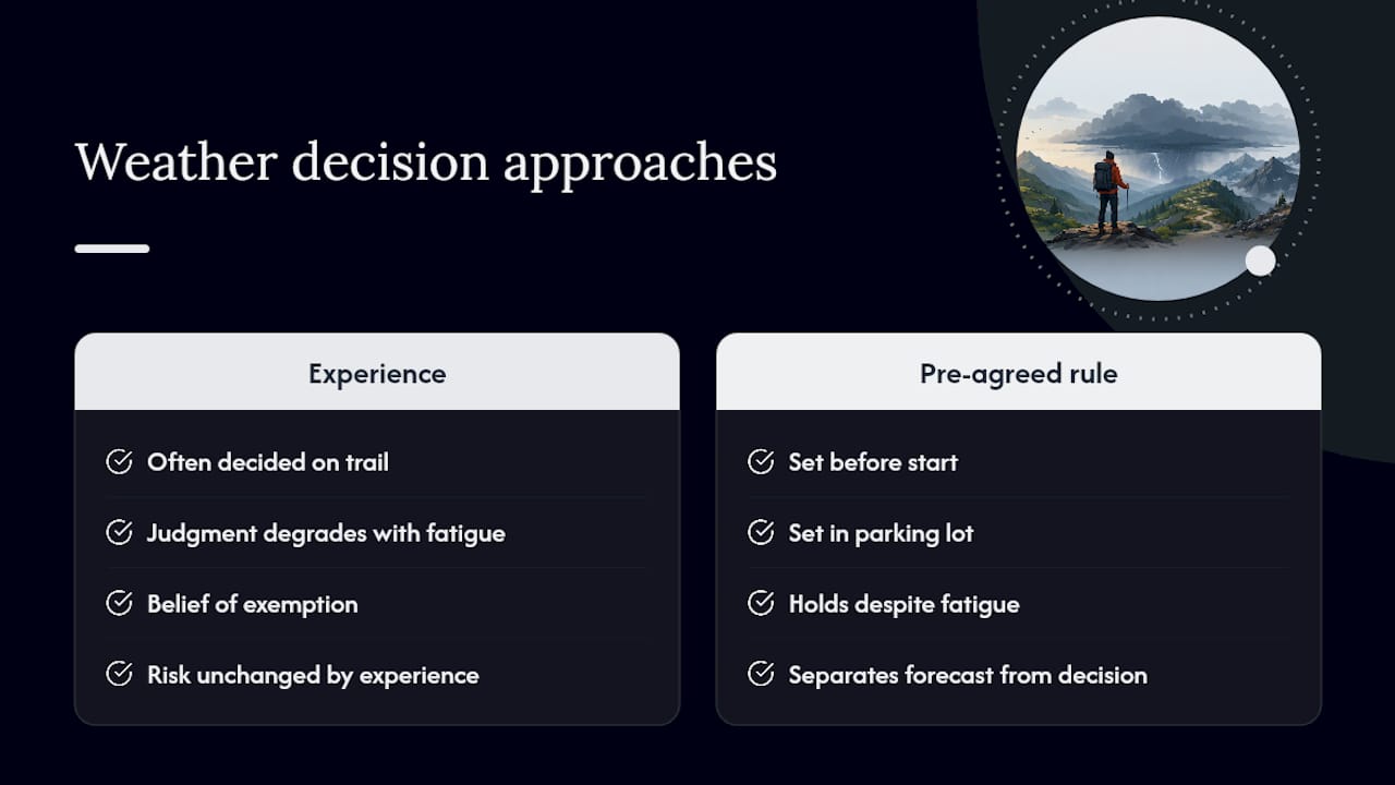
The biggest mistake I see in outdoor communities isn’t ignorance of weather risk. It’s the belief that experience makes you exempt from it. People who’ve hiked for twenty years get struck by lightning at the same rate as beginners, because the sky doesn’t care how many summits are on your résumé. What actually protects you is a boring, pre-agreed rule that you follow even when the trip feels too good to cut short.
Thrillofit builds its guidance around that boring discipline on purpose. A turnaround time set in the parking lot, before anyone’s tired or excited, holds up better than any decision made three miles in with a storm building. That’s not caution for its own sake. It’s just recognizing that judgment degrades under fatigue and summit fever exactly when the stakes go up.
If there’s one habit worth adopting from this guide, it’s separating the forecast from the decision. The forecast tells you what’s likely. The decision, made calmly beforehand, tells you what you’ll actually do when the sky starts doing something else. Explore more Thrillofit outdoor adventure guides to keep building that judgment before your next trip.
This article is general information, not a substitute for advice from a qualified doctor. Consult a qualified healthcare professional about your own circumstances before acting on anything here.
Sources
The gap between a useful forecast and a useless one comes down to precision and elevation. A valley forecast tells you almost nothing about what’s happening 3,000 feet higher, where storms form first and fastest.
Reading an NWS hourly graph takes practice: look for the precipitation probability curve alongside the wind speed line, not just the temperature. A sudden wind spike paired with rising precipitation odds is your cue that conditions are shifting faster than the daily summary suggests.
Pro Tip: Set watch and warning alerts for your specific county before you leave cell service. A watch means conditions are possible; a warning means they’re happening now, and that distinction should change your plan immediately.
Recommended
Comments